PHILIPSBURG:--- Members of Parliament from the UPP, NA, and NOW have formally requested that the Prime Minister provide a written update to Parliament in response to the recent correspondence received from WICSU-PSU concerning the ongoing labor dispute within the Fire Department.
In the correspondence from the Unions, a 48-hour deadline has been issued to the Prime Minister in light of the serious concerns about the absence of decisive action after months of mediation, the failure to acknowledge the agreement letter submitted on January 23, 2026, the prolonged operational strain caused by nearly ten months of go-slow actions, and the demand for the signing of the agreement letter together with a result oriented meeting involving the Council of Ministers and Parliament within the stated timeframe.
With Parliament scheduled to continue deliberations on this matter, the factions is urging the Government to urgently address the escalated 48-hour matter involving the Fire Department and to provide Parliament with a written update before public meetings continue, so as to avoid further antagonizing an already fragile situation and deepening the ongoing crisis.
Members of Parliament have indicated that such an update is essential to clarify the Government’s current position and intended next steps, provide transparency regarding the status of the agreement resulting from mediation, and allow Parliament to deliberate responsibly and with full awareness of developments affecting public safety.
The factions stress that the Union’s 48-hour deadline underscores the urgency of the matter, and wholeheartedly disapprove of the manner in which this Government is treating our emergency service personnel. All hands must be on deck to ensure our firefighters remain motivated to serve and are able to see a tangible end result.
Members of Parliament remain committed to working toward a resolution that restores normal operations within the Fire Department and safeguards the people of Sint Maarten.
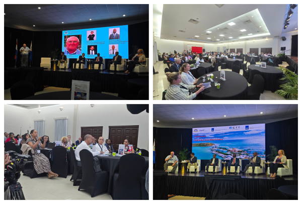
 PHILIPSBURG:--- The second day of the Strategic Economic Stakeholders Consultation focused on the evolving future of tourism, yachting, safety, sustainability, and economic resilience for Sint Maarten. During the morning panel discussion, regional and local experts shared frank perspectives on the opportunities ahead, while emphasizing the need for coordinated action, data-driven decision-making, and a stronger national vision.
 PHILIPSBURG:--- The Supreme Court of the Netherlands has upheld the convictions of Claudius Buncamper and Maria Buncamper Molanus, a couple involved in bribery and corruption on Sint Maarten. The case, stemming from the Ruby investigation, focused on irregularities in the tendering process for the island's landfill and abuse of official positions.
 PHILIPSBURG:--- Minister of Public Health, Social Development and Labor (VSA), the Honorable Richinel Brug, has welcomed the launch of the joint compliance campaign by the Tax Administration, Social & Health Insurances (SZV), and the Stichting Belastingaccountantsbureau (SBAB), describing it as a strong example of effective inter-institutional collaboration in support of national financial sustainability.