


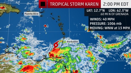
 PHILIPSBURG:--- At 5:00 am, the center of Tropical Storm Karen was located near latitude 11.9 north, longitude 60.2 west or about 461 miles south of St. Maarten. Karen is moving toward the west-northwest near 09 mph (15 km/h) and this general motion is expected to continue today. A turn toward the northwest is forecast to occur on Monday, followed by a turn toward the north on Tuesday. On the forecast track, Karen will move across the Windward Islands this afternoon and tonight, and emerge over the southeastern Caribbean Sea Monday morning. The center of Karen is forecast to pass 145 miles west of St. Maarten on Tuesday afternoon.
Maximum sustained winds are near 40 mph (65 km/h) with higher gusts. Little change in strength is forecast during the next 48 hours.
Tropical-storm-force winds extend outward up to 125 miles (205 km) from the center.
2. A strong tropical wave along the west coast of Africa is already producing thunderstorm activity that is showing some signs of organization. Environmental conditions are conducive for further development, and a tropical depression or tropical storm is expected to form on Monday or Tuesday while it moves westward to west-northwestward across the eastern tropical Atlantic at 15 to 20 mph.