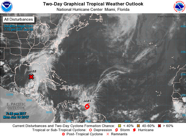
 MIAMI/PHILIPSBURG:---- The National Hurricane Center is issuing advisories on Potential Tropical Cyclone Two, located a couple hundred miles east-southeast of the southern Windward Islands.
* Formation chance through 48 hours...high...80 percent.
* Formation chance through 5 days...high...80 percent.
1. A broad area of low pressure extends from north of the Yucatan Peninsula across adjacent portions of the southern Gulf of Mexico.
This system is producing a large area of disorganized shower and thunderstorm activity well east and northeast of the low over much of the eastern Gulf of Mexico. While this system does not have a well-defined surface circulation, satellite wind data indicate that tropical-storm-force winds are occurring in a band 100 to 150 miles northeast of the broad low. Upper-level winds are expected to be marginally conducive for some additional development of this system during the next day or two while it moves northward to northwestward into the central Gulf of Mexico, and a tropical or subtropical cyclone is likely to form during that time. Regardless of development, interests along the U.S. Gulf Coast from the Central Texas coast to the western Florida Panhandle should monitor the progress of this system, as a tropical storm watch or warning, could be needed for portions of this area later today.
Also, heavy rains are expected to continue over portions of Central America, the Yucatan Peninsula, the Cayman Islands, western Cuba, the Florida Keys, the Florida Peninsula, and spread into Central and Eastern portions of the U.S. Gulf Coast during the next day or two. An Air Force Reserve Hurricane Hunter aircraft is scheduled to investigate this system this afternoon. For more information on this system, please see the High Seas Forecasts issued by the National Weather Service.
* Formation chance through 48 hours...high...80 percent.
* Formation chance through 5 days...high...80 percent.
Public Advisories on Potential Tropical Cyclone Two are issued under WMO header WTNT32 KNHC and under AWIPS header MIATCPAT2.
Forecast/Advisories on Potential Tropical Cyclone Two are issued under WMO header WTNT22 KNHC and under AWIPS header MIATCMAT2.
High Seas Forecasts issued by the National Weather Service can be found under AWIPS header NFDHSFAT1, WMO header FZNT01 KWBC, and on the Web at http://www.opc.ncep.noaa.gov/shtml/NFDHSFAT1.shtml.


