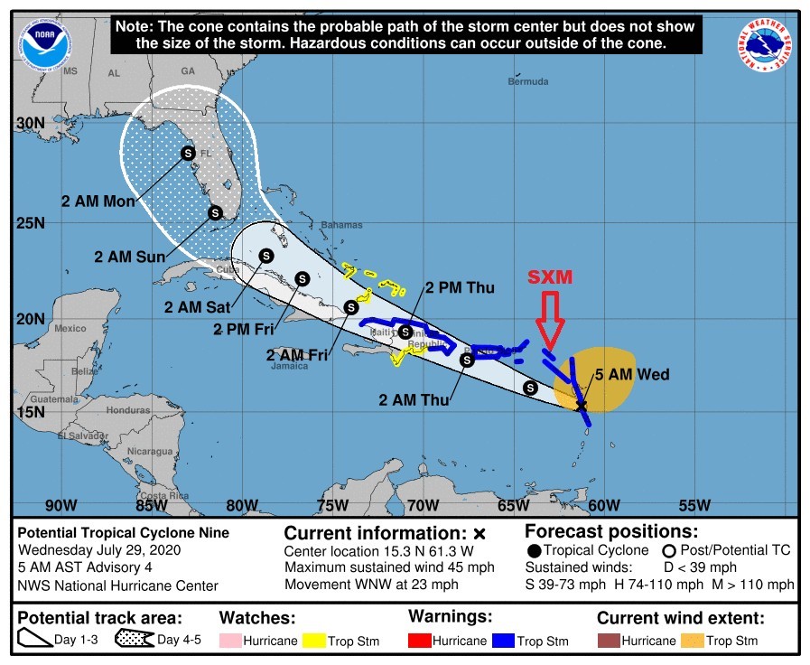
 PHILIPSBURG:--- At 5 AM (0900 UTC), the potential tropical cyclone was centered near latitude 15.3 North, longitude 61.3 West or about 230 miles southeast of St. Maarten. The system is moving toward the west-northwest near 23 mph (37km/h). This general motion with
A slight reduction in forwarding speed is expected over the next few days.
On this forecast track, the center of the system is forecast to be at its closest at about 135 miles southwest of St. Maarten this afternoon.
Maximum sustained winds are near 45 mph (75 km/h) with higher gusts. Some strengthening is expected today with weakening likely by Thursday.
Tropical-storm-force winds extend outward up to 275 miles (445 km) from the center. Overnight a gust of 33kt (38 mph) was reported at PIJA.
The estimated minimum central pressure is 1005 mb (29.68 inches).
HAZARDS AFFECTING LAND:
WIND: Windy conditions are expected to continue through today with higher gusts up to tropical storm force.
RAINFALL: The potential tropical cyclone may produce total rain accumulation of 2 to 6 inches. This rainfall could result in flooding in low-lying areas and rock falls along hillsides. Rainfall is expected throughout the day with increased activity by this afternoon. Some of this rainfall may be accompanied by thunderstorms.
SEAS: Sea conditions will continue to deteriorate with swells peaking near 15 feet today. A small craft warning for St. Maarten remains in effect until further notice. Small craft operators are advice to stay in port to avoid loss of life and property.
• Residents in areas prone to flooding or near the coast should be vigilant and monitor their surroundings.
• The general public should continue to monitor the updates from the Meteorological
Department of St. Maarten.